The solution for city and countrywide mapping with aerial imagery
SURE Aerial is specifically designed for aerial image datasets captured with large frame nadir cameras, oblique cameras and hybrid systems with additional LiDAR sensors. Without limitation in image resolution, it empowers the production of 3D Meshes, True Orthophotos, Point Clouds and Digital Surface Models on common workstation hardware and in cluster environments. Simple to setup and operate, SURE Aerial is compliant with mapping industry standards and accessible for web streaming technologies. Connect seamlessly with interfaces such as various Aerotriangulation import options, shapefile definitions and several output formats.
SURE 5.2
SURE 5.2 enables a more cost-effective True Ortho and Mesh generation by reducing both processing time and hardware requirements. 3D Mesh production workflows have become easier than ever before, while delivering better looking results out of the box! Mesh Editing and Clipping is introduced, facilitating the delivery of areas of interest to your customer. Additional flexibility is at your fingertips with the capability of incorporating LiDAR data from multiple flight days.
Optimised for large datasets
Fully automatic workflow
Generate tiled DSMs, True Orthophotos and Meshes automatically. No manual seam line editing or expert knowledge required to produce high-quality outputs.
Region of interest definition
Choose to process the most essential elements of your projects. Take control of the time and efficiency of your production. Import 2D or 3D shapefiles for waterbodies, areas of interest and surface correction.
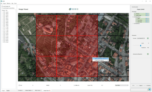
Efficient visualization of large datasets
Benefit from optimized level-of-detail and streaming formats for web-visualization (cesium, ESRI slpk, osgb, obj, collada). The free SURE Viewer is included with the upgradable SURE Editor.
Unlimited Scalability
Whether you're working with 2,000 or 20,000 high resolution images, SURE Aerial scales with you and your project needs.
Cost efficient image acquisition and processing
Choose the image acquisition method that works for your organization. Use oblique images, high quality Nadir images or data provided by hybrid systems with additional LiDAR sensors. Experience highly efficient processing built for handling large datasets on your existing hardware.
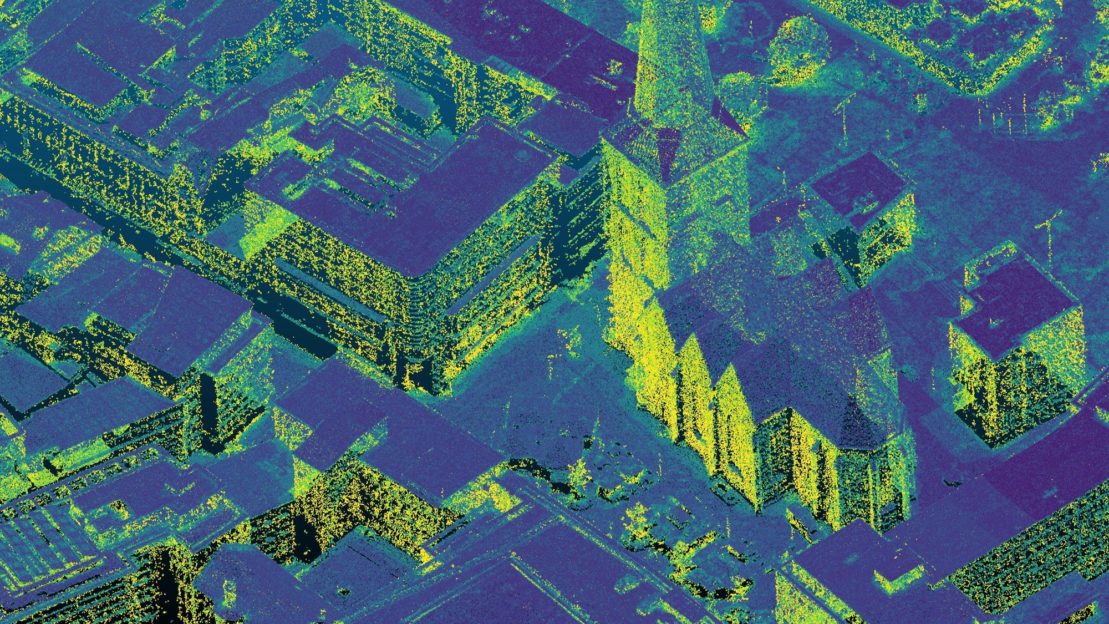
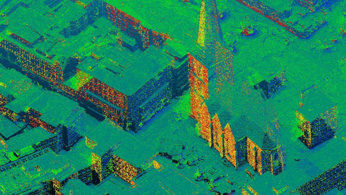
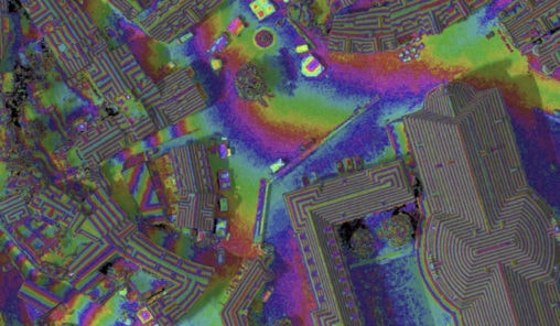
Colorized DSMs
Generate colorized DSMs to represent accurate height differentiation data.
Full feature list
- Dense Image Matching
- Depth information for each pixel with sharp edges
- Multi-threading and GPU support
- Colored Point Clouds (las, laz)
- Digital Surface Models (tif, gtif, tfw)
- True Orthophotos (tif, gtif, tfw)
- Textured 2.5D and 3D Meshes (OGC I3S, OGC 3D Tiles, obj, osgb, collada)
- Global Color Balancing
- Automatic seam-line leveling and homogeneous blending
- Point Clouds and True Orthophotos with 8 Bit, 16 Bit and 4 channels
- All kinds of frame imagery
- Small, medium and large frame (e.g. >500 megapixels)
- Close range, UAV, manned aircraft (nadir, oblique)
- Transfer full image information to deliverables (8/16 Bit RGBI)
- LiDAR Point Cloud import (las, laz)
- Elastic Distributed Processing
- Scale to any size of datasets / timelines
- Add additional nodes while processing
- No setup and interactive management of cluster required
- Attractive license rental packages
- Completely scriptable and configurable with command line interface
- Open interfaces
- Direct orientation import from Trimble Inpho/Match-AT, Leica HxMap, Agisoft Metashape, Pix4D and more
- Point Cloud import (las or laz)
- LiDAR Trajectory import (sbet, sol)
- Editing & data interaction
- 2D or 3D shapefiles for waterbodies and surface corrections
- Region of interest definition for processing and export
- Mapsheet definition (tiling scheme)
- Refeed edited or 3rd party Point Clouds to workflow
- SURE Editor (Mesh editing tools improving Meshes, True Orthos and DSMs)
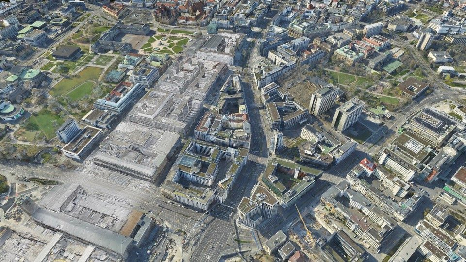
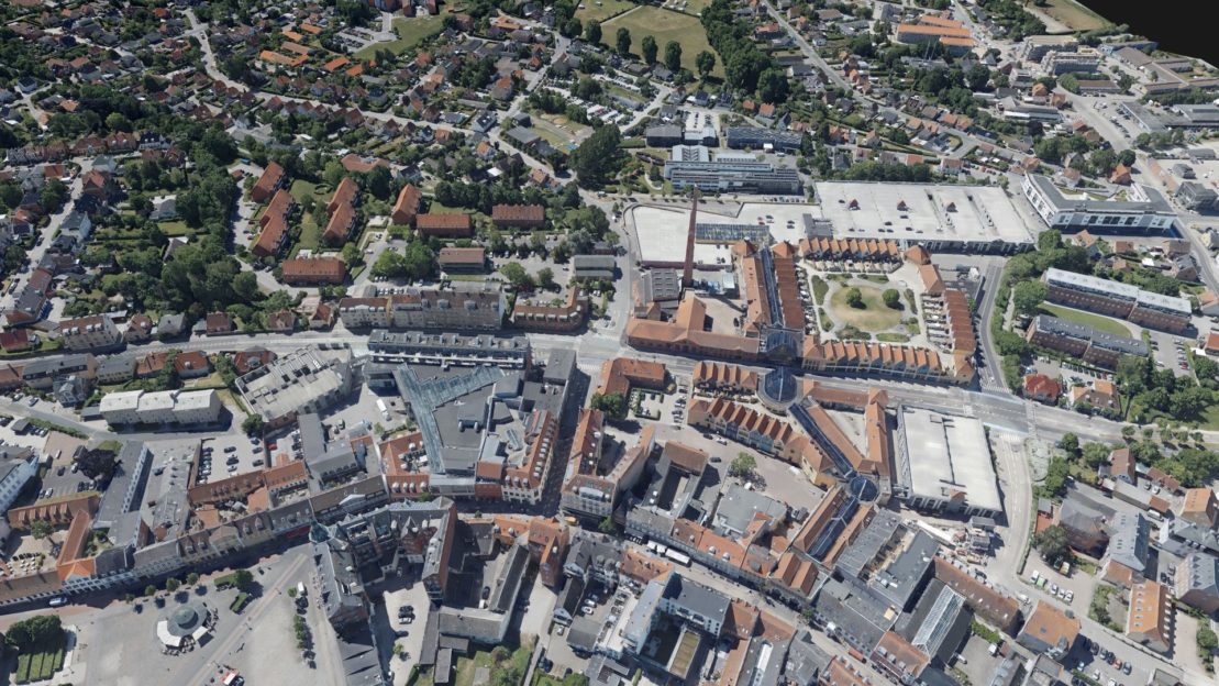
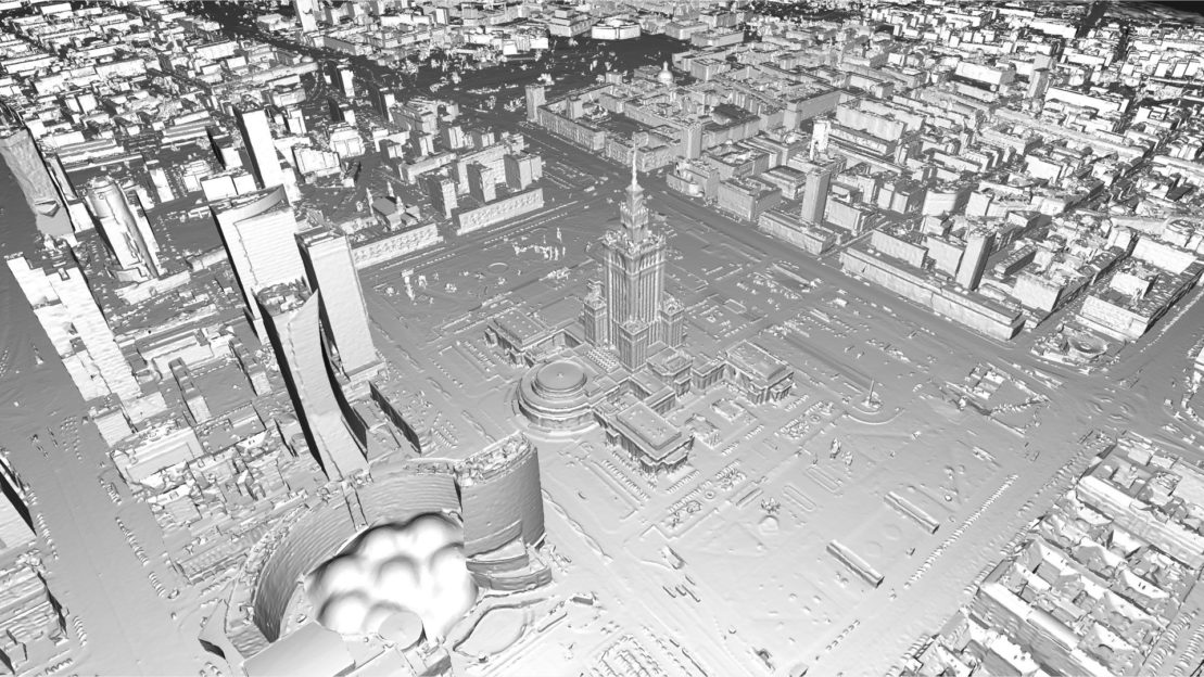
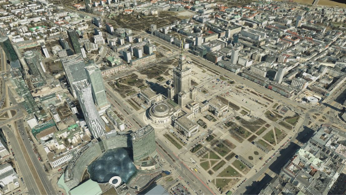
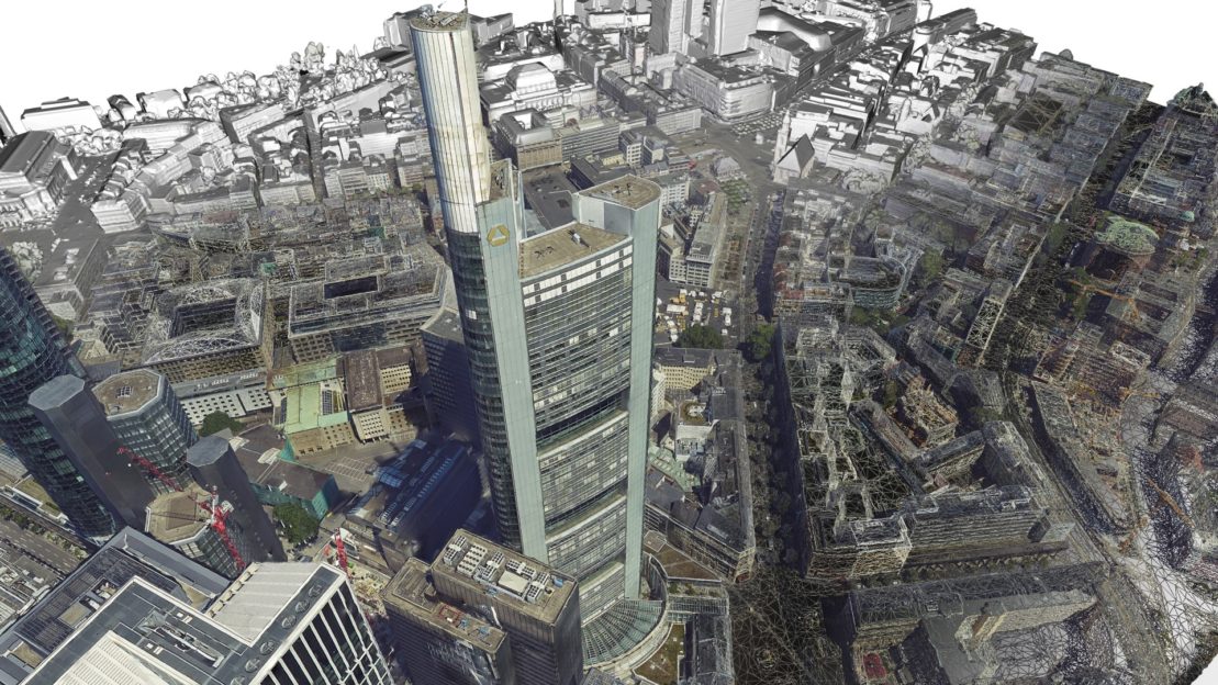
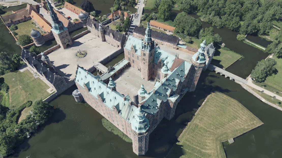
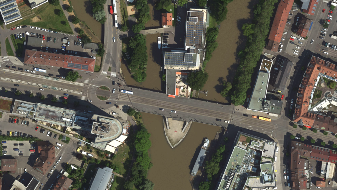
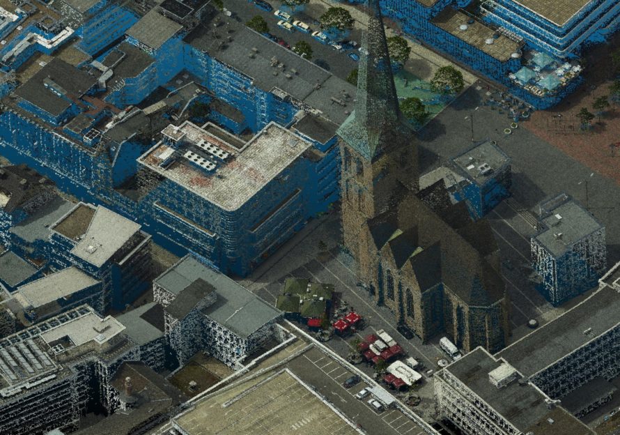
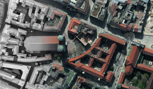
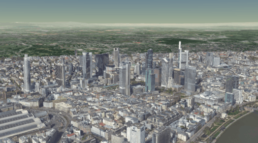
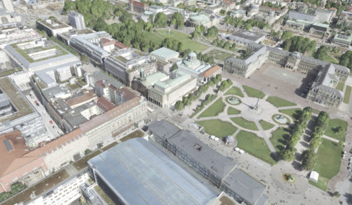
Example Outputs
Captured nadir and oblique imagery rendered fully automatically using SURE Software to create customized products such as True Orthophotos and Textured 3D Meshes.